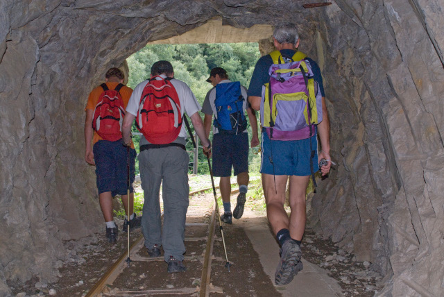
Die rauen Felsenwände des Unteren Veltlins halten einen der berühmtesten und den Kennern des Mountainbike bekannten Trail versteckt: den Tracciolino. Eine wirklich suggestive, oberhalb des Lago di Novate Mezzola in die Felsen geschlagene Strecke, die unvergleichliche Ausblicke und 22 zu durchquerende Galerien schenkt, bevor die Rider Codera, ein charakteristisches Bergdorf erreichen, das vom Tal aus nur über Pfade erreichbar ist.
Die Strecke ist normalerweise von März bis November befahrbar.
Frequently asked questions
HOW DO YOU ARRIVE AT THE TRACCIOLINO ITINERARY?
You can get to the trail from Novate and Verceia.
From Verceia:
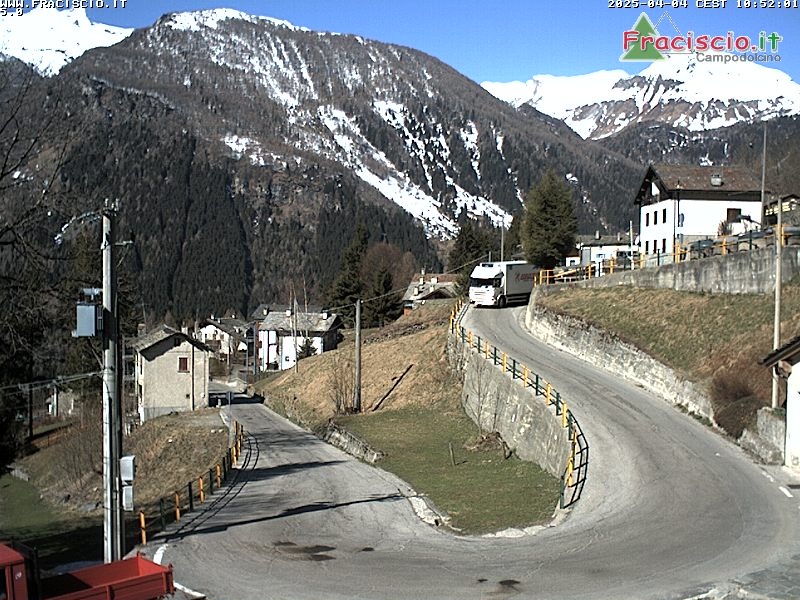
• by car, take the Via Serto, then the road which leads up to the hamlet of Vico (a distance of just over 1 km). Above Vico the pastoral track begins, alternating between asphalted and dirt tracks for around 7 km. We recommend to continue by car only if the vehicle is sufficiently raised above the ground and if following a single lane track, somewhat narrow, feels safe.
• on foot: follow the mule-track leaving from the end of the Via Serto or alternatively take the road adopted by cars.
IS THE USE OF CARS ON THE ROAD LEADING TO THE TRACCIOLINO SUBJECT TO PAYMENT?
As far as the habitation of Vico, movement is free; transit along the pastoral track that begins immediately after Vico is however subject to the purchase of a pass (daily 5,00 euro, three day 10,00 euro, weekly 25,00 euro). Movement is monitored by cameras.
WHERE IS IT POSSIBLE TO PURCHASE THE PERMIT?
The permit can be purchased at shops/bars in the town: Bar Val di Ratt, Bar Micio, La Brasa Steakhouse, Hotel Saligari. In exceptional circumstances or in the event of the premises indicated above being closed, it´s possible to validate transit by sending an email to polizialocale@comune.verceia.so.it, indicating the CAR NUMBER PLATE, DATE OF TRANSIT and by effecting a transfer in the name of Comune di Verceia at Banca Popolare di Sondrio IBAN: IT 05 F05696 52240 000046405X17 (indicating the vehicle number plate and the day of movement.)
WHERE IS IT POSSIBLE TO PARK?
Parking is allowed along the edge of the track, obviously ensuring the passage of other vehicles on their way up/down. It is not permitted in the area of manoeuvre at the end of the lane where emergency vehicles may need to intervene.
HOW DOES THE TRACCIOLINO TRAIL DEVELOP?
Once you have reached the setting off point (easily identifiable by the special information panels), the Tracciolino takes off to the left (in a north-westerly direction); heading to the right, in 15 minutes it´s possible to reach the Moledana dam.
IS IT AN ITINERARY SUITABLE FOR CHILDREN?
The tracciolino is a path on the level suitable for children, but not prams and pushchairs due to the presence of rails and uneven ground.
WHAT TYPE OF EQUIPMENT IS RECOMMENDED?
Mountain-style equipment is advised (shoes and suitable clothing). For stretches in tunnels, a fleece-style top is ideal even in summer, and take a torch.
IS IT POSSIBLE TO TRAVEL THE LENGTH OF THIS ITINERARY BY MOUNTAIN BIKE?
The trail is suitable for cyclists with reasonable experience along irregular paths. The first stretch is on the level and fine for standard mountain biking. Near the turn for San Giorgio it´s currently bikes by hand.
ARE THERE ANY REFRESHMENT POINTS ALONG THE ROUTE?
The first option is located in San Giorgio. Then further on, at Codera. We recommend you take water along with you as there are no fountains on the route. Alternatively there is a refuge at Frasnedo in Val dei Ratti which you can reach in about 45 minutes on foot from the start of the Tracciolino.
IS THE ITINERARY ALWAYS TRAVERSABLE?
The trail is normally closed in the winter for safety reasons related to the presence of ice/snow. However we recommend that you check for any possible impromptu closures on the relevant institutional sites and / or the public bulletin board of the Comune di Verceia and Novate Mezzola.
