A really enjoyable outing to one of the most popular scenic spots in the entire valley.
by Salvatore Fontana
I thought long and hard about which might be an appropriate route for an outing this summer. The Sommarovina loop certainly fits the bill and is one of my favourites. Perfect both for those with athletic training aboard their regular bike, or for those who prefer to get about on a pedal-assisted partner.
Setting out from the San Vittore church at Mese, we head into the via Cappella Grande, running alongside the important hydroelectric power station built between 1922 and 1927, and which at the time was the largest in Europe. Keeping to the right, the road begins to climb a little in the via Madonna della Grazie, and continues in via Motto. After about 250 metres shift right towards Albareda at around 5 km from the start, situated above the “pillars of Mese”, rockfaces particularly popular with climbers. Once at Albareda and the church of San Antonio, it’s time for a break: there’s a handy fountain and a refreshment point with with benches and tables to have a snack and take a breather, enjoying the wondrous view to the East of Pizzo di Prata (il Pizzone) and southwards you can follow the development of Valchiavenna all the way down to Lake Novate with the peak of Mount Legnone up above.
Back on the road we continue to climb for a further couple of km and as we stick to the left towards Calones the chestnut woods begin to open out and we make Prat Morello on the mound of Cipolino at 1140m. On the left sits a little chapel, the “nösa capeleta” where there’s another spot for a pause and refreshments. We’re at the centre of three valleys here and we can appreciate them in all their magnificence. To the north Valle Spluga, from the sanctuary at Gallivaggio to Motta di Campodolcino as far as the peaks of the Suretta. To the east the meadows of Dalò at 1000m, and up above you will note the top of Lagh (3083m) and Pizzo Stella (3163m), whilst the length of Valchiavenna opens up to the south.
From here we begin to descend, retracing the path for around 800m at the first left turn. The road climbs briefly and the surface changes from asphalt becoming a path with a decent base, we move down passing through a cluster of baite, typical mountain huts to take the path on the left. We’re around half-way up the valley side (at 1000m) where we meander gently into woodland. Passing through Teccial we note further baite and move down to the right where a fountain beckons and the way continues down and widens. Further down a sign indicates the whereabouts of the Church of Sommarovina, well worth a look and from where we can admire Valbregaglia stretching away to the East. Take in the peak of Pizzo Badile (3305m), the dam at Villa di Chiavenna, the Acqua Fraggia waterfalls at Prosto, and have a very particular aerial view of Chiavenna itself at the centre of the three valleys. Going back down there are any number of natural waterfalls to
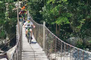
admire. From Sommarovina, the road is one of asphalt once more as far as San Giacomo Filippo, where a left turn is recommended to get to the sanctuary of San Guglielmo. Moving on we cross the new cycle/pedestrian bridge which takes us back to the main SS36 which we follow for around a km heading south towards Chiavenna. Once through San Giacomo Filippo at the fourth bend, take a right to return to the path, cross over the bridge, where on the right there’s a beautiful waterfall, then follow the via Spluga and at the first junction head left for the Tibetan bridge.
From here Chiavenna awaits.
